University of New England (UNE) researchers have released an interactive digital tool enabling hundreds of thousands of visitors each year to Port Arthur, Tasmania, to experience the sites and stories of its convict past in a new way.
The new digital mapping tool depicts data from fresh archaeological scans and archival maps and records by a cross-institutional research team, filling out the picture of life, work and punishment for Port Arthur convicts.
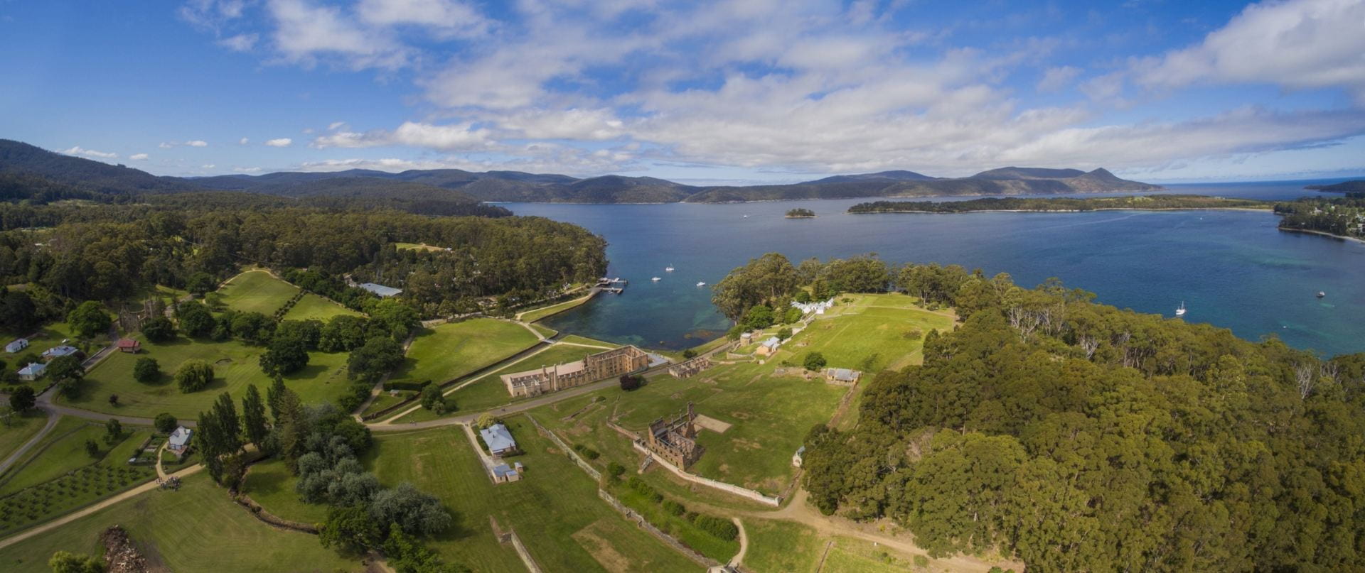
“Between 1830 and 1877, Port Arthur operated primarily as a destination for male convicts who reoffended in the colony – men regarded as the worst of their kind,” says UNE Archaeology Research Fellow Dr Richard Tuffin, working onsite at Port Arthur.
As such, it’s become a place in our psyche that conjures dark images of the lash, leg-irons and hard labour. Landscapes of Production and Punishment, a collaborative research project between UNE, the University of Tasmania, University of Liverpool and Port Arthur Historic Site Management Authority, is about re-examining the record to see whether it is a fair portrayal.
Using the results of the analyses, Dr Richard Tuffin has populated the digital mapping tool with the places, people and stories of Port Arthur between 1830 and 1877, which is free for researchers and the public to explore.
The digital mapping project collates data from physical scans of the landscape using cutting-edge technology like GIS (Geographic Information System) and LiDAR (Light Detection and Ranging) mapping, and the stories of work, life and justice from personal and public records, to build a picture of life in Port Arthur.
Visitors to the website can view more than 600 convict offences linked to the locations where the offences were committed, or choose to view an overlay of the architectural plans of each building, sourced from the Tasmanian archives.
Rather than offering a single snapshot of history, the mapping tool details the places and events over every year of Port Arthur’s 47 year history from 1830 to 1877. Viewers can use a time-slider to focus on any particular year.
“The mapping is designed to run on a mobile device and has GPS functionality, so visitors to the Port Arthur Historic Site will be able to use it to see where buildings once were, or stand right on the spot where an offence occurred over 150 years ago,” Dr Tuffin says.
“This tool is designed for those interested in how an important penal station evolved over its 47 year history.”
Chief Investigator for the Landscapes project, Professor Martin Gibbs, UNE Archaeology, says it’s an exciting development in the project.
“This is a rare and excellent example of how academic research can be made available to the general public,” he says.
The map is live from mid-November 2019 and can be explored at www.convictlandscapes.org.au
Landscapes of Production and Punishment: the Tasman Peninsula 1830-1877 is an Australian Research Council-funded project (DP170103642) undertaken by: Professor Martin Gibbs, Associate Professor David Andrew Roberts and Dr Richard Tuffin, University of New England (UNE); Dr David Roe, Dr Jody Steele and Ms Susan Hood, Port Arthur Historic Site Management Authority; Professor Hamish Maxwell-Stewart, University of Tasmania; Professor Barry Godfrey, University of Liverpool.

Webmap of Port Arthur in 1836
Recent Comments