Hi all. Thought some of you may be interested in our latest article that has come out in Australian Archaeology: ‘Landscapes of production and punishment: LiDAR and the process of feature identification and analysis at a Tasmanian convict station‘. It looks at the use of LiDAR remote sensing data in the location, visualisation and analysis of convict landscapes. There are eprints available for the first 50 copies. Enjoy!
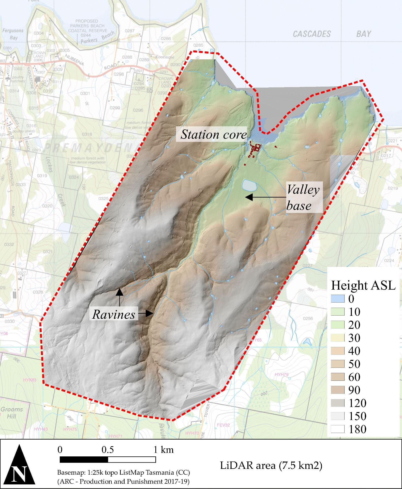
Figure from the paper